2023.09.20
News
10 students of the Water Science and Disaster Risk Reduction, Department of Civil and Environmental Engineering, have attended the international meeting
In August, 2023, 10 students of the Department of Civil and Environmental Engineering have participated in Asia Oceania Geosciences Society 20th Annual Meeting (AOGS2023) held in Singapore by AOGS. 6 out of 10 students belong to Arikawa Lab. and the rest 4 belong to Tebakari Lab.
The AOGS annual meeting aims to promote geoscience and its application for the benefit of humanity, especially in Asia and Oceania, by tackling global scale issues in a comprehensive approach. AOGS hosts an annual meeting to provide academia, research institutes, and the public the unique opportunities to discuss and exchange scientific insights in order to deal with material geoscience issues. Researchers from Asia and Oceania regions got together for this year’s Annual Meeting, too. Those students participated in the annual meeting actively shared their opinions orally or by presenting posters. They gained new knowledge and information which will contribute to their future researches. Moreover, they got a chance to listen to others’ research presentations ranging to broad topics which they won’t get familiar with in usual academic life. The students were surely inspired a lot.
Below are the details of participated students and their research contents.
Arikawa Lab.
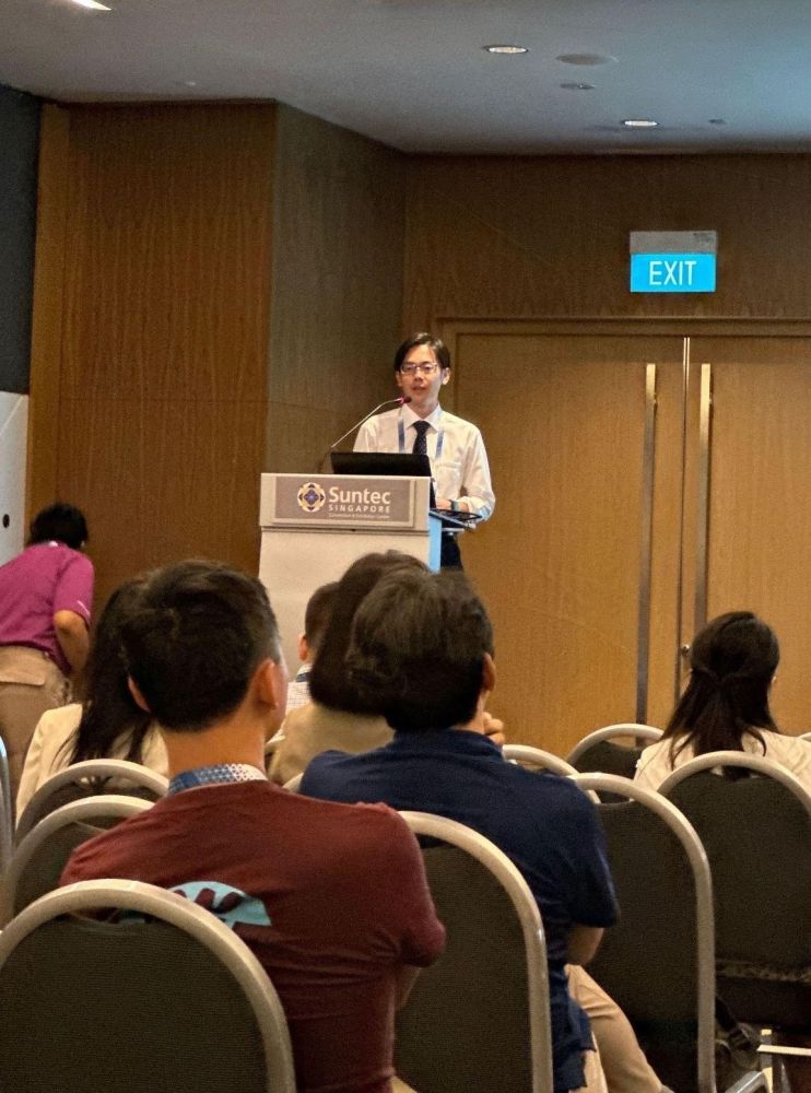
【D1】Tomoki Shirai (Oral Presentation)(Abstract Peer-Reviewed)
Presentation Title: Global Tropical Cyclone Prediction Using Non-Hydrostatic AGCM at Various Spatiotemporal Scales and Applicability to Storm Surge Simulation
Author: Tomoki SHIRAI, Taro ARIKAWA
Abstract: Typhoons and storm surges are disasters that cause significant damage to coastal areas. Accurate and reliable predictions are essential for damage mitigation. Numerical simulations, specifically the AGCM (Atmospheric General Circulation Model), are used for typhoon predictions. Various AGCMs exist, but none are perfect, making it crucial to integrate results from multiple models. In this study, in addition to the widely used WRF meteorological model in coastal engineering, the MPAS model with an unstructured grid was applied for typhoon and storm surge predictions. Its usefulness was demonstrated by comparing it to the conventional method (WRF).
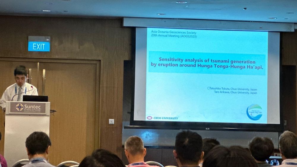
【M2】Tatsuhiko Tokuta (Oral Presentation)(Abstract Peer-Reviewed)
Presentation Title: Sensitivity Analysis of Tsunami Generation by Eruption around Hunga Tonga-Hunga Ha’api.
Author: Tatsuhiko TOKUTA, Taro ARIKAWA
Abstract: In 2022, a volcanic eruption in Tonga generated tsunamis exceeding 1 meter globally, with tsunamis over 10 meters in the islands of Tonga. The global tsunamis were analyzed to have been amplified by pressure waves called Lamb waves generated during the eruption, and ocean waves propagated by atmospheric gravity waves through Proudman resonance. This study conducted a sensitivity analysis of tsunami generation from eruptions around Tonga. Tsunami calculations were conducted using the water displacement source from the eruption, similar to preceding research. Additionally, three-dimensional calculations of the eruption were carried out, improving the tsunami height's reproducibility by accounting for momentum.
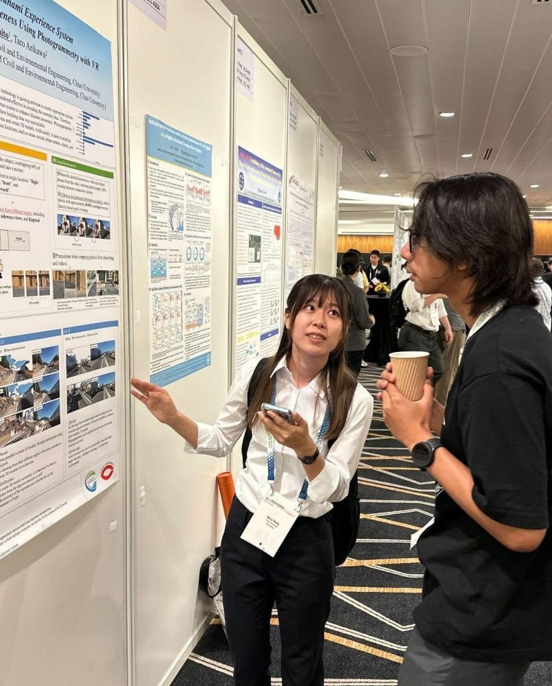
【M1】Rena Naito (Poster Presentation)(Abstract Peer-Reviewed)
Presentation Title: Construction of Tsunami Experience System to Improve Evacuation Awareness Using Photogrammetry with VR
Author: Rena NAITO, Taro ARIKAWA
Abstract: Following the 2011 Tōhoku earthquake and tsunami, there were instances of individuals not evacuating due to a cognitive bias called the "normalcy bias". Drawing from this lesson, it's essential to regularly conduct disaster-preparedness education and drills. In recent years, research using XR (Extended Reality) technologies to promote appropriate behaviors during specific disaster scenarios has gained attention. This study examined a tsunami experience system using VR (Virtual Reality). Using photogrammetry, which captures subjects from various angles to create 3D models, guidelines were established and applied on-site. By allowing residents to simulate experiencing a tsunami, this system is expected to promote timely evacuation during real disasters.
【M1】Riku Takakura (Oral Presentation)(Abstract Peer-Reviewed)
Presentation Title: Effect of Density on Wave Forces Under Sediment Laden Tsunamis Based on Three-dimensional Numerical Simulation
Author: Riku TAKAKURA, Naoki TANIGUCHI, Yota ENOMOTO, Taro ARIKAWA
Abstract: During the East Japan Earthquake, tsunamis laden with dark, muddy sediments were observed. Samples collected after the tsunami confirmed a higher density than regular seawater. However, the effects of sediments on wave forces remain largely unknown. In this research, hydraulic model experiments and numerical simulations were conducted to examine the wave forces of sediment-laden tsunamis, focusing on the impact pressure. The numerical calculations exhibited high reproducibility for wave height when compared to experimental values. Although wave forces were slightly underestimated, the calculations successfully replicated impact pressures. Furthermore, results indicated that sediment-laden tsunamis might increase wave forces more than the rate of density increase due to viscosity.
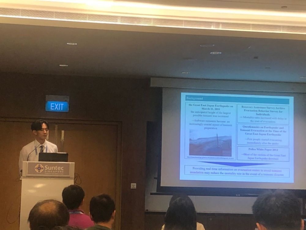
【M2】Fukuto Yoshida (Oral Presentation)(Abstract Peer-Reviewed)
Presentation Title: Proposing Evacuation Route Selection Method Using Tsunami Arrival Time Probability as Advance Information Evacuation Route Selection Method
Author: Fukuto YOSHIDA, Masaki ISHIYAMA, Taro ARIKAWA
Abstract: Since the East Japan Earthquake, Japan has emphasized not only hard countermeasures such as seawalls but also soft measures like evacuation. Recently, the effectiveness of probabilistic approaches, which consider uncertainties in tsunami inundation assessments, has been highlighted. However, research considering numerous tsunami scenarios to determine evacuation routes remains scarce. This study generated tsunami arrival time probabilities from multiple tsunami scenarios, proposing a method to search for low-risk tsunami encounter evacuation routes using these probabilities as prior information.
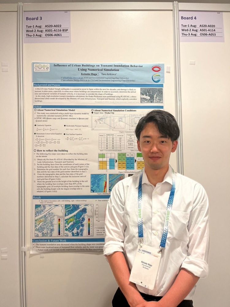
【M2】Keisuke Haga (Poster Presentation) (Abstract Peer-Reviewed)
Presentation Title: Influence of Urban Buildings on Tsunami Inundation Behavior Using Numerical Simulation
Author: Keisuke HAGA, Taro ARIKAWA
Abstract: Within the next few decades, an earthquake along the Nankai Trough is anticipated. The potential for extensive damage in urban areas, where buildings are concentrated, is a concern. In numerical calculations, a common method to consider building influences is adjusting roughness coefficients based on land use. However, to accurately grasp the tsunami's arrival time and velocity variations, it's crucial to consider building shapes. Using the three-dimensional urban model PLATEAU developed by the Ministry of Land, Infrastructure, Transport, and Tourism, this study conducted high-resolution tsunami inundation calculations for the urban area of Osaka Prefecture, considering building shapes. Results showed that including buildings reduced the tsunami inundation range but increased the flow velocity and inundation depth in some areas. Future challenges include aligning these physical quantities with actual measurements through hydraulic model experiments.
Tebakari Lab.
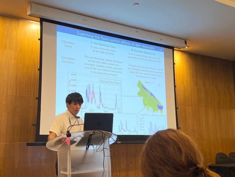
【D1】Kei KOURA (oral presentation)(Abstract Peer-Reviewed)
Presentation Title: Examining the Method of Pre-discharge from Dam Reservoirs for Flood Damage Mitigation in Central Vietnam
Authors: Kei KOURA,Naoki KOYAMA,Tadashi YAMADA
Abstract: Flooding occurs almost every year in Vietnam, inundating low-lying coastal areas. In addition, the number of annual floods is increasing, and it is estimated that precipitation will increase with future climate change, increasing vulnerability to flooding. On the other hand, the river basins in central Vietnam have dam reservoirs not only for flood control purposes but also for water utilization, which could be utilized to reduce flood damage. This study numerically analyzed the effects of dam reservoir releases on river water levels and inundation depths with the aim of reducing flood damage in the river basins of central Vietnam. As a result, by applying a pre-release method that utilizes observed rainfall information upstream of the dam reservoir, we were able to reduce river water levels and inundation depths downstream while maintaining water storage capacity for power generation and agricultural use. It was also shown that greater benefits could be achieved if all rainfall upstream of the dam reservoir could be stored in the dam reservoir.
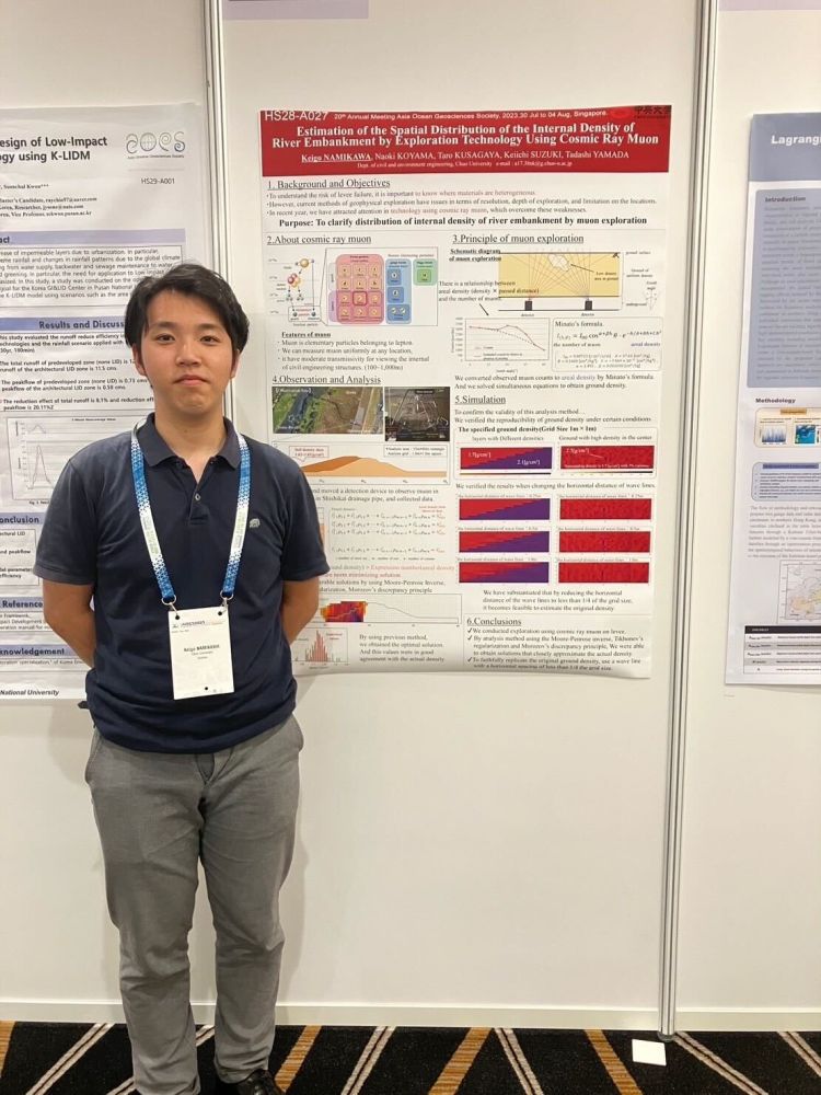
【D1】Keigo NAMIKAWA (poster presentation)(Abstract Peer-Reviewed)
Presentation Title: Estimation of the Spatial Distribution of the Internal Density of River Embankment by Exploration Technology Using Cosmic Ray Muon
Authors:Keigo NAMIKAWA,Naoki KOYAMA,Taro KUSAGAYA,Keiichi SUZUKI,Tadashi YAMADA Abstract: To evaluate the risk of levee failure, it is important to obtain updated information of the internal condition and weakness area of the levee. However, previous physical exploration techniques have limitations in spatial resolution and feasible locations. Therefore, we applied exploration technology using cosmic ray muon to levees in this research. Furthermore, we proposed a newly developed inverse analysis technique from the field of control engineering, thereby showing an enhancement in the precision of estimating internal density.
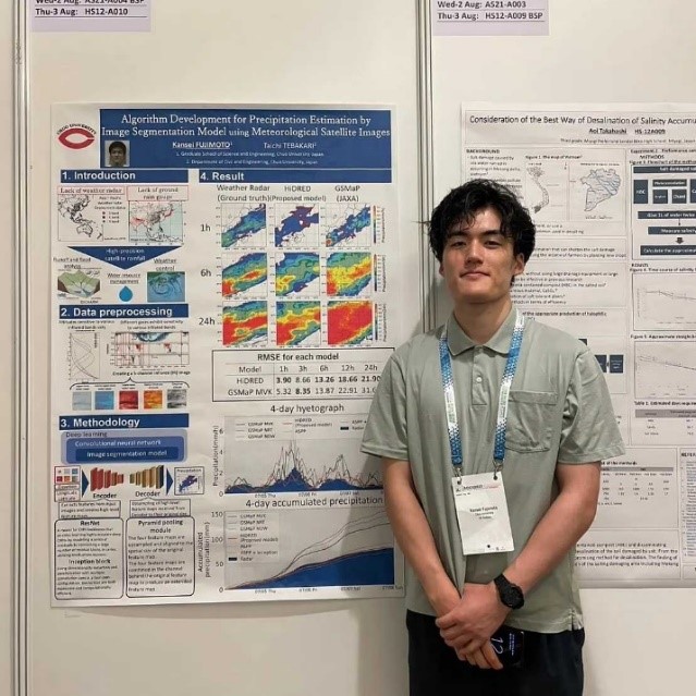
【M2】Kansei FUJIMOTO (poster presentation)(Abstract Peer-Reviewed)
Presentation Title: Algorithm Development for Precipitation Estimation by Image Segmentation Model Using Meteorological Satellite Images
Authors: Kansei FUJIMOTO, Taichi TEBAKARI
Abstract: With climate change becoming more severe in recent years due to global warming and other factors, accurate precipitation data from meteorological satellites is expected to play an important role in disaster prevention and agriculture in regions where ground rain gauges and radar rain gauges are not fully deployed. Recently, many deep learning models have been developed, among which image segmentation models are useful for precipitation estimation from meteorological satellite images. This study aims to develop an algorithm that can estimate precipitation more accurately from weather satellite IR bands using multiple image segmentation models. Many image segmentation models for deep learning CNNs have been developed from around 2015 to the present. Among them, we select a model that excels in precisely discriminating rainfall areas and estimating precipitation intensity using IR band brightness temperature information, latitude and longitude, and elevation data. We also extract features from the IR band as training data, aiming for a model with high generalization performance. The satellite data used was the Himawari elevation data. In addition to the brightness temperature information, latitude, longitude, and elevation data were provided for the training data. The National Synthetic Radar GPV was used as the teacher data. The spatial resolution of the Sunflower standard data is 2 km. The satellite observations used for the training data and the radar images used for the teacher data have different observation targets: cloud particles and raindrops, respectively. Therefore, the observed brightness temperatures and precipitation intensities do not always agree with the peak positions. The training and teacher data are varied from 2 km to 10 km at 2 km intervals to see which estimation results are more reasonable. The results showed an improvement in the accuracy of precipitation estimation compared to nonparametric regression.
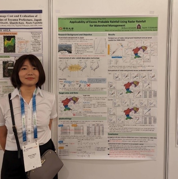
【M2】Shihori OHASHI (poster presentation)(Abstract Peer-Reviewed)
Preentation Title: Applicability of Excess Probable Rainfall Using Radar Rainfall for Watershed Management
Authors: Shihori OHASHI,Taichi TEBAKARI
Abstract: Although Japanese weather radar observation technology has improved dramatically, the data accumulated over a long period of time is rarely used for statistical analysis. Considering the possibility that radar rainfall may replace ground rainfall observation in the future, it necessary to examine whether radar rainfall could be used for statistical analysis. In this study, we examined the applicability of radar rainfall to watershed management based on a comparative analysis of the probable rainfall between radar and ground rainfall data. As a result, it was shown that radar rainfall could be applied to watershed management except for some watersheds. In the future, we will examine specific methods of applying radar rainfall to watershed management.
【D1】 Tomoki Shirai
【M2】 Keisuke Haga
【D1】Keigo Namikawa
【M1】 Rena Naito
【M2】Shihori Ohashi
【M2】Kansei Fujimoto
【D1】Kei Koura
【M2】 Fukuto Yoshida
【M2】 Tatsuhiko Tokuta
【M1】Riku Takakura
