2023.02.06
River Basin Disaster Resilience and Sustainability by All
- Taichi Tebakari
- Professor, Faculty of Science and Engineering, Chuo University
Areas of Specialization: Civil Engineering, Hydrology, and Water Resources Research
1. New water management policy: River Basin Disaster Resilience and Sustainability by All (RBDRSA)
Many people generally imagine water management as the prevention of flooding and mitigation of flood damage, as represented by the term flood control. However, if you look up the term "water management" in the dictionary, you will find that it also includes the aspect of water utilization, as it is described as the development, improvement, and maintenance of water channels and waterways to prevent flood damage or facilitate transportation and irrigation, or collectively "water management projects."
In the past, an important role in water management was fulfilled by institutions such as the Home Ministry and the Ministry of Construction. This role is now fulfilled by the Ministry of Land, Infrastructure, Transport and Tourism. These ministries work to ensure the safety and security of citizens in accordance with the River Act. The River Act originated with the so-called Old River Act that was enacted in April 1896. This act was revised in July 1964 (Showa River Act) and revised again in June 1997 (Heisei River Act) to meet the needs of the times. The Old River Act in the Meiji Period emphasized water management rather than water utilization. Then, in conjunction with socio-economic growth after World War II, there was a rapid increase in the use of river water for hydroelectric power generation, industrial water, and other uses. In response, the act was revised to the Showa River Act. Then, in the Heisei River Act, environmental aspects were positioned to be equally important as water management and water utilization.
The United Nations Framework Convention on Climate Change was enacted at the Earth Summit held in Rio De Janeiro in 1992, and since that time, there have been whispers of a climate crisis. The 20th anniversary issue of the magazine Newton published in July 2001 was titled "Era of Global Floods" and included a special feature on the possibility that global warming could increase the risk of flooding. Furthermore, a special feature published in National Geographic in April 2010 was titled "Water: Our Thirsty World."
Since around 2008, severe flood damages have occurred frequently in Japan almost every year. For example, a heavy rain emergency warning was issued for the first time for severe flood damage on the Kii Peninsula in 2011. There was also heavy rain in Niigata and Fukushima in the same year. In the 2015 Kanto and Tohoku heavy rains, the banks of the Kinugawa River collapsed, leaving a large number of citizens stranded. Images shown on the news resembled a scene from a movie or TV drama. In 2016, Hokkaido was struck by three typhoons in one week, and the resulting impact on agricultural production spread throughout Japan. This was followed by heavy rains in western Japan in 2018 and Typhoon Hagibis in 2019. Research is still being conducted to accurately assess whether or not all such extreme flood damages are caused by climate change, but many researchers would probably agree that climate change is causing an impact to some extent.
In consideration of current conditions, the Japan Society of Civil Engineers announced "Proposal for Future Disaster Prevention and Mitigation Based on Typhoon Hagibis Disaster: A Shift to RBDRSA That Unites Rivers, Flood Control, Regions, and Cities" on January 23, 2020. Here, the term of river basin has a broad meaning that refers to the catchment area surrounded by the watershed, the area in which river flooding spreads, the water utilization area where river water is used, the wastewater area where wastewater flows after using the river water, and the range of ecosystems centered on the river. RBDRSA refers to the cooperation among rivers, flood control, regions, and cities in designing water management policy for developing rivers, implementing measures to suppress flooding, conducting localized and wide-area flood prevention to prepare for flooding, and designing communities and ways of living for convenience, comfort, safety and security. In other words, in order to adapt to large-scale flooding, RBDRSA consists of comprehensive measures which include intangible flood prevention measures, regional policy and planning, and urban policy and planning should be strengthen, instead of water management policy that has been implemented in the form of "lines" such as rivers and "points" such as dams, and that collaboration among all people and organizations composing the river basin is crucial. As if in response to such thinking, in July 2020, the National Land Development Council of the Ministry of Land, Infrastructure, Transport and Tourism issued a report titled "Water-Related Disaster Risk Reduction Considering Climate Change ーTransition to River Basin Disaster Resilience and Sustainability by Allー."
Of course, the Japanese government and the Ministry of Land, Infrastructure, Transport and Tourism (former Ministry of Construction) have not been standing idly by now. Through reports such as the June 1977 report by the River Council entitled "Methods of Promoting Comprehensive Water Management Measures" and the December 2000 interim report by the River Council Planning Subcommittee entitled "Effective Water Management Measures Including Measures for River Basins," in addition to river improvements such as dams and embankments, government organizations have implemented measures such as controlling runoff by building dikes, raising the height of residential land, enacting land use policies, strengthening cooperation between rivers and sewage systems, and building storage facilities, as well as producing and publishing hazard maps. An advanced example of RBDRSA is a local ordinance concerning the promotion of river basin water management in the Shiga Prefecture that was enacted in 2014. On the basis of measures to ensure flow through river improvement, the ordinance is taking action ahead of the national government by calling for storage by ensuring water permeation in forests and farmlands, as well as by maintaining rainwater storage and permeation functions in parks, buildings, etc., for stoppage by minimizing damage through restrictions on construction on floodplain, for enhancement of emergency action methods and regional disaster prevention capability, and for maps of land surface safety which indicate districts prone to flooding which include normal rivers, etc., which are normally not required to be published.
In order to develop more effective measures, the Ministry of Land, Infrastructure, Transport and Tourism amended nine acts as part of the Act for Partial Amendment of the Act on Countermeasures against Flood Damage of Specified Rivers (commonly known as the flood-control-related-laws).
The Japanese government's basic approach to RBDRSA can be broadly divided into the following three categories: (1) measures to prevent and reduce flooding as much as possible, (2) measures to reduce the number of victims, and (3) measures to mitigate damage and enable faster recovery and rebuilding. Firstly, the countermeasures included in (1) mainly include development of rivers, development of rainwater storage and permeation facilities, use of reservoirs and other forms of water management, water management through dams for water utilization, and improvement of water retardant functions integrated with land use. Next, the countermeasures included in (2) go far beyond conventional water management measures to include regulations and guidance on land use, promotion of relocation, provision of flood risk information during real estate transactions, and consideration of financial guidance. Finally, the main countermeasures for (3) include elimination of blank areas of flood risk information, provision of multistage flood risk information, fundamental improvement of flood prediction, promotion of BCP formulation, provision of flood risk information during real estate transactions, and promotion of flood measures through financial products.
The Japanese government is strongly appealing for a shift to RBDRSA which is carried out by all concerned parties throughout the basin. It is important that many of the measures introduced above will be implemented by people such as residents and companies, who were not the main players in the past.
2. Developing a menu for RBDRSA
Many of the specific tangible measures for RBDRSA are nothing more than summaries of conventional water management measures, while some of the intangible measures have excellent ideas, even if they are not easily feasible.
Our research group aims to create an unprecedented menu of tangible measures. One such measure is the proposal of a positive flood water drainage method that takes into account the agricultural calendar and utilizes the backwater phenomenon in the network of agricultural drainage channels. Agricultural drainage channels have major advantages such as large channel capacity, connection with rivers, and lower land than the surrounding ground. Another advantage in terms of management is the low level of interest from users. On the other hand, the low level of recognition among local residents is a drawback in terms of safety. Furthermore, by considering the agricultural calendar and specifying the periods during which flooding is permitted, we believe that it is possible to reduce the impact on farming and create a situation in which it is easier to obtain the cooperation of farmers. Moving forward, we will also consider increasing the aggressiveness of selective flood drainage by integrating the growing season, such as early maturation, mid maturation, and late maturation.
Currently, with the cooperation of the Idagawa River Land Improvement District, which is located on the left bank of the basin for the Jinzugawa River that flows through Gifu Prefecture and Toyama Prefecture, we are developing an observation system and preparing for a water guidance experiment. For four farm fields, in order to monitor the behavior of water in rice paddies and the condition of water channels during rain, we installed hydro-meteorological gauges in four locations, as well as water level gauges in 22 locations in rice paddies. However, we have already encountered many issues. For example, a nationwide issue is the lack of basic fundamental data that is indispensable for creating future river basin water management measures; for example, a lack of micro-topography survey data to prevent flooding of houses around fields, and a lack of river data. Also, although the rice paddies have existed since ancient times, it is interesting in a scientific sense that the dynamics of water in the fields is not precisely understood. Currently, we are in the stage of constructing a hydrological model that can quantitatively evaluate the flood control effect of rice paddies.
Regarding the use of agricultural land with high potential for RBDRSA, there is still only one countermeasure: rice paddy dams (storage in rice field). We would like to improve this situation. Our new measures can be applied to areas where residential land and agricultural fields are mixed, which are difficult conditions to deal with. The new measures do not require a large amount of cost or construction, and it is easy to obtain understanding from agricultural workers. Furthermore, our technical developments can also be incorporated into RBDRSA during the agricultural off-season (non-irrigation season).
Moving forward, if this proposed technology is established and the disadvantages are shared with farmers, what will the downstream city residents and companies who can enjoy safety do to compensate them? Even if such situation can be solved with money, what kind of mechanisms exist? In fact, even after the underlying technology is established, the need to reach a consensus within the community as a whole remains. In order to lower such a difficult hurdle as soon as possible, we must start discussing RBDRSA on a region-by-region basis from today.
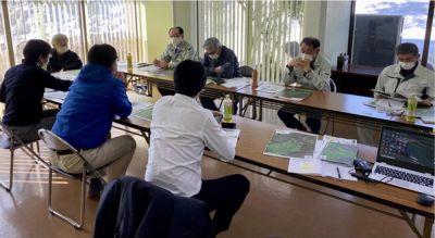
Interviewing the Idagawa River Land Improvement District
3. Issues and vision for RBDRSA
Although RBDRSA sounds like a measure that will solve any problem, I recognize that the path to success is fraught with difficulties. Broadly speaking, I recognize the following seven major issues.
- Approximately 50% of the population and about 75% of the assets are concentrated in flood risk areas that make up about 10% of the national land. In order to implement policy which moves from individual lines (river channels) to a comprehensive strategy (river basin), it is necessary to discuss the form of national land and the state of the local community. Time will be required to reach a consensus. To begin with, there remains a fundamental problem that the concept of RBDRSA has yet to achieve mainstream acceptance.
- It is necessary to test whether the current river channel is able to safely accommodate downstream flow at the scale of the current river plan. After this testing, it should finally be possible to determine the scale of floods that can be tolerated in RBDRSA, and a consensus should be reached.
- The scientific and engineering evaluation of the underlying technology for RBDRSA is still largely lacking, and the actual situation is that the concept of RBDRSA is merely an expectation.
- The problem of sediment is not yet included in RBDRSA. Sediment management is an important river basin issue ranging from mountain management to water management and coastal management.
- RBDRSA is about allocating damage such as flood allowance and relocation. As such, it is truly an issue of allocating damage. Consequently, it creates new questions: What damage should be minimized? Who should incur damage? Where should damage be incurred?
- There is no leader (person, agency/organization) for RBDRSA.
- The Japanese government claims to include all stakeholders, but the reality is that few are included.
Finally, it cannot be said that RBDRSA is a form of justice. If taxpayers and voters wish to continue the current water management policy, then the Japanese government has no choice but to comply with these wishes. However, due to the above-mentioned many grave issues, considering the tax burden and allocation in an era of declining birthrate and aging population in Japan, it is difficult to protect local communities with conventional water management plans. Accordingly, I believe that the concept of RBDRSA must be spread to the general public. I hope Japanese citizens will strongly recognize that RBDRSA is not just a flood control policy; instead, it is an important piece for considering the socio-economic condition of regions, cities, and the country as a whole.
If given the opportunity, I would like to provide information on consensus building for RBDRSA.
Professor, Faculty of Science and Engineering, Chuo University
Areas of Specialization: Civil Engineering, Hydrology, and Water Resources Research
Taichi Tebakari was born in Tokyo. He completed the Doctoral Program with a major in civil engineering in the Graduate School of Science and Engineering, Chuo University in 2006. He holds a Ph.D. in engineering.
In 2002, he was appointed as a Researcher in the Public Works Research Institute. In 2006, he was appointed as Teaching Assistant and then as Assistant Professor in the Department of Civil Engineering of the Faculty of Engineering, Fukuoka University. In 2009, he was appointed as Instructor and then as Associate Professor in the Faculty of Engineering, Toyama Prefectural University. He assumed his current position in 2021.
His areas of expertise are civil engineering, hydrology, and water resources research. He studies water disasters and social issues. His life work is researching water-related issue, particularly in Southeast Asia and Thailand.
